Seattle Census 2000 Demographics Maps
Library of Congress Map Collection: 1500-2004
Perry-Castañeda Library Map Collection
TerraServer (Satellite Photos and Aerial Photography)
Earthshots: Satellite Images of Environmental Change
Washington State Environmental Learning Centers
Winter Quarter
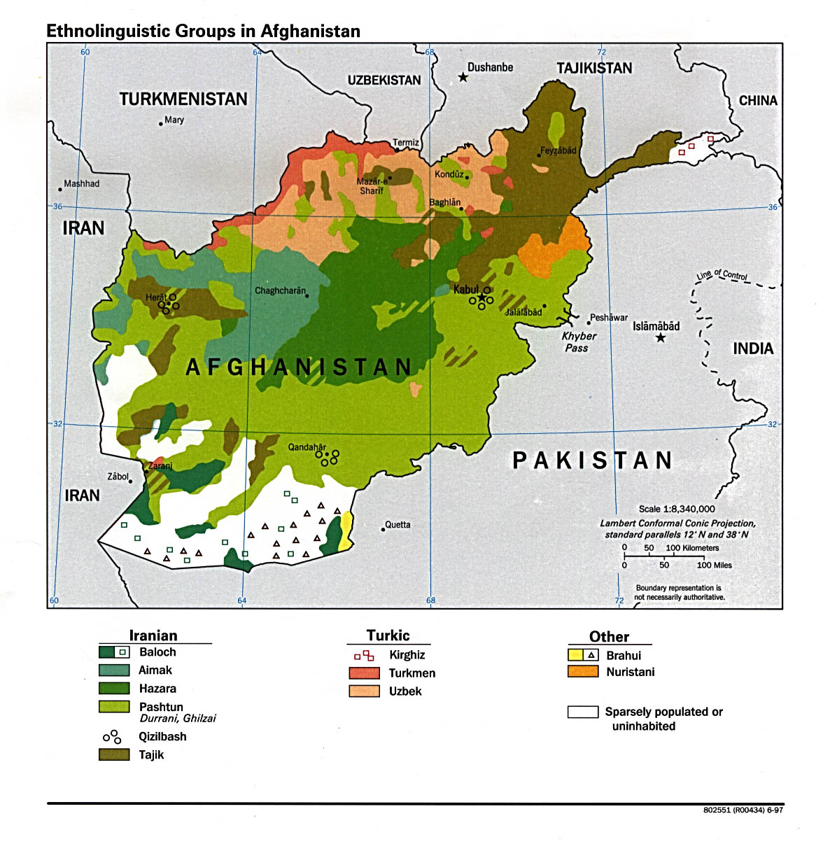
Afghanistan
Afghanistan 2003
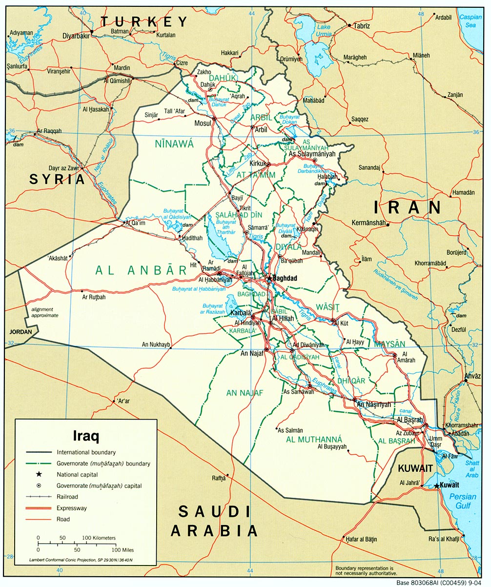
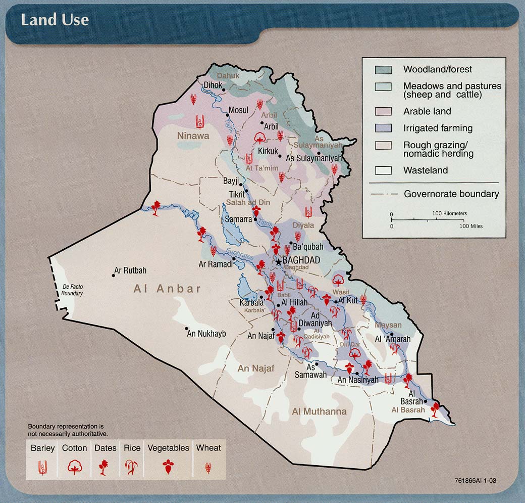
Iraq
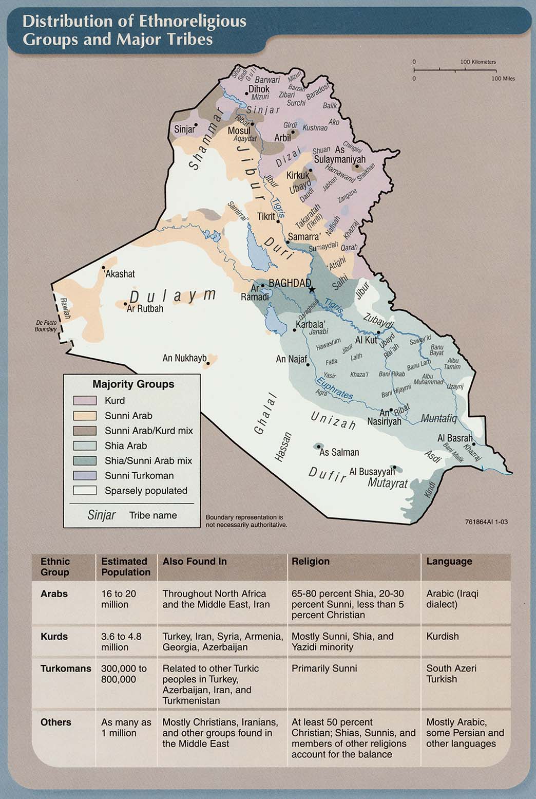
Distribution of Ethnoreligious Groups and Major Tribes
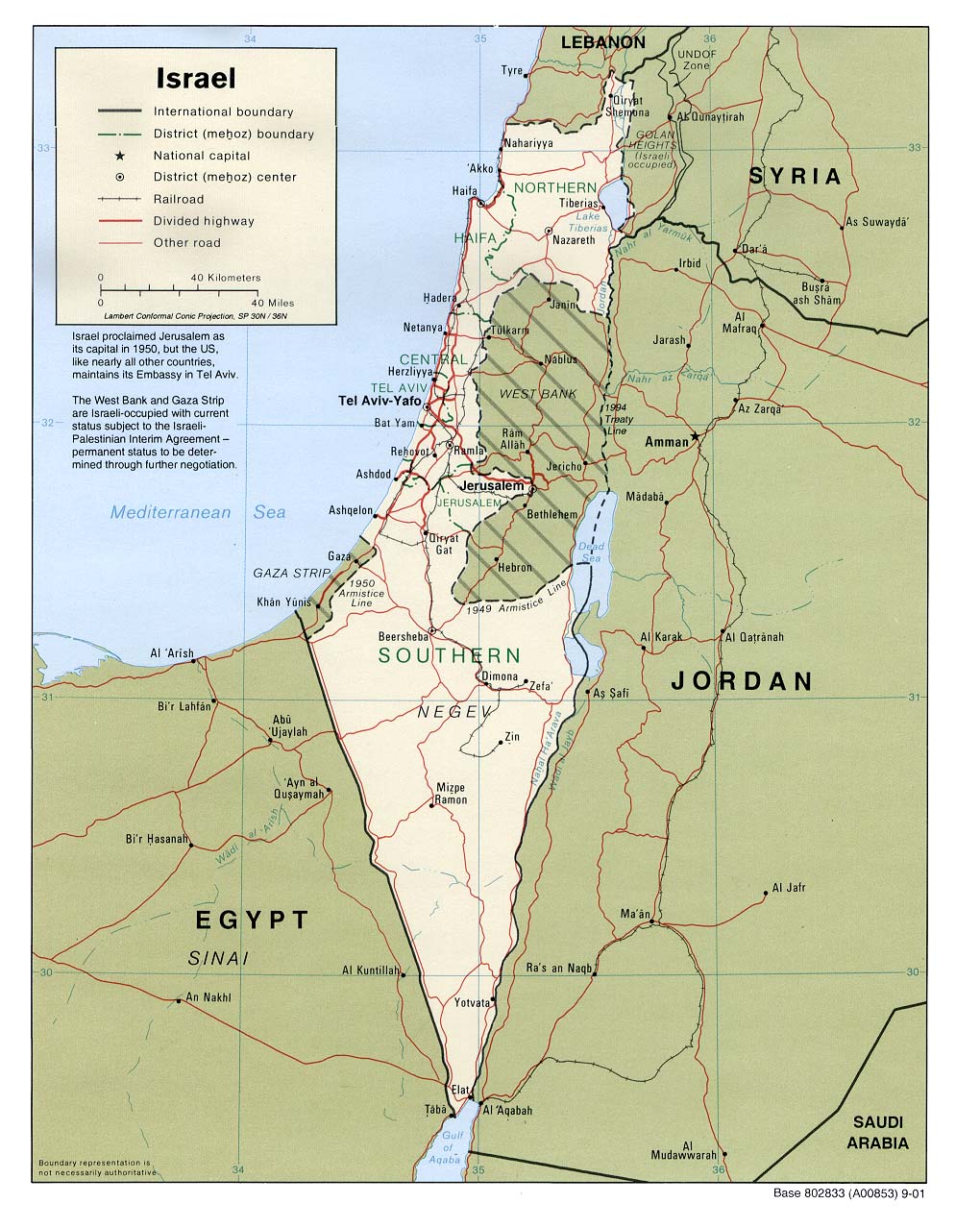
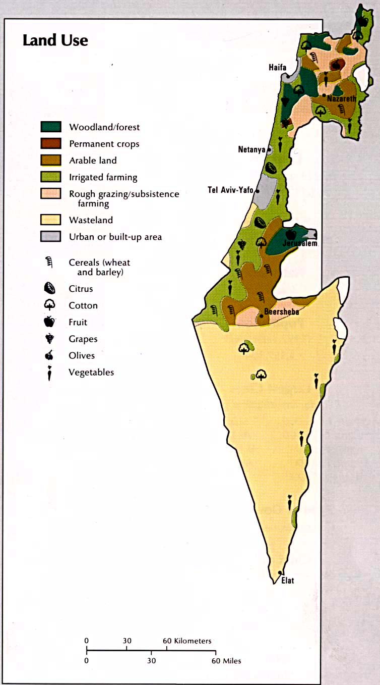
Israel/Palestine
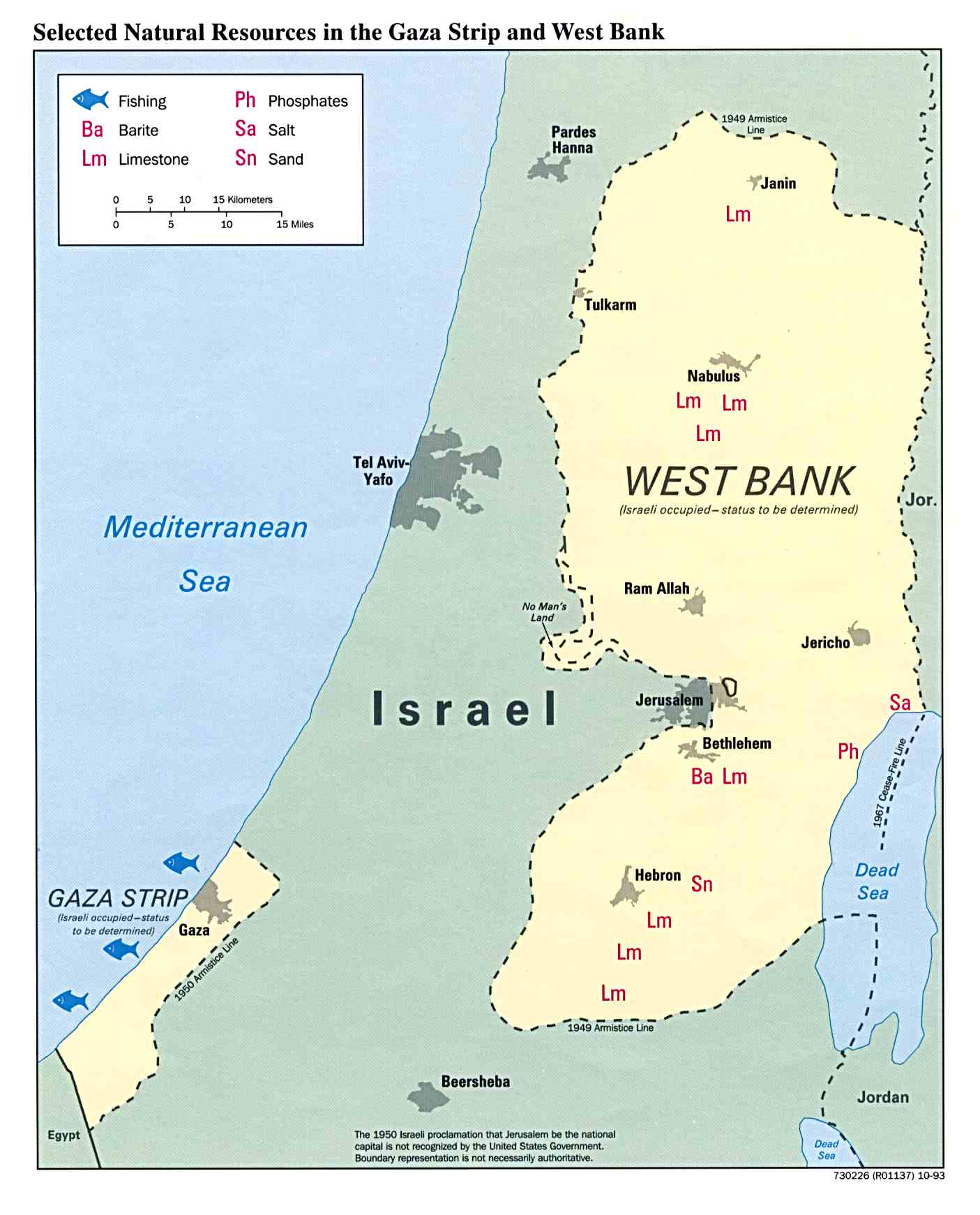
Palestinian Territories (occupied by Israel)
West Bank (large map)
West Bank Checkpoints
Gaza Checkpoints
Checkpoints North of Jerusalem
Globalization: Cities, Borders, Prisons
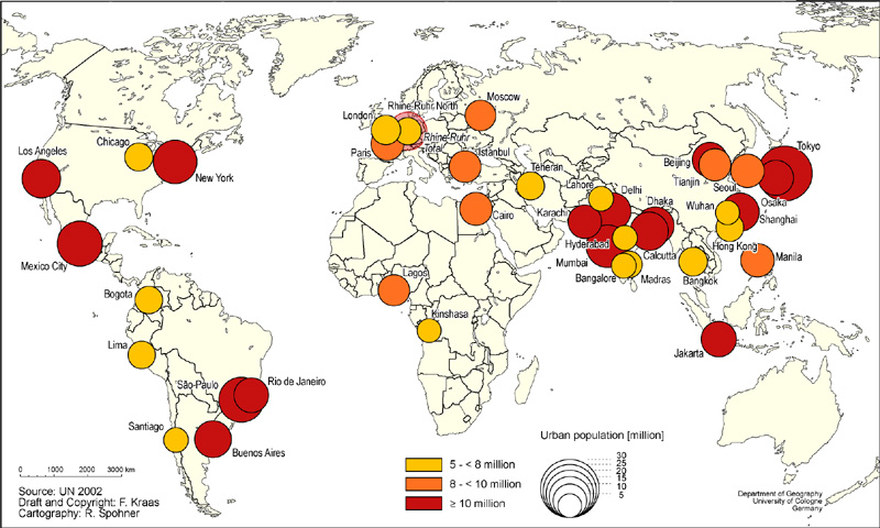
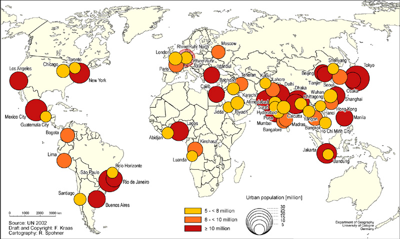
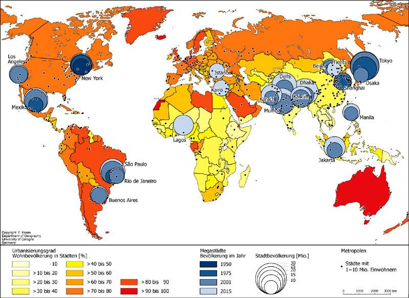
Cities
Population Trend and Rate of Urbanization
Prison, Military, and Pollution
US Military Bases Continental US (pdf)
US Military Deployment 1969-2004
US Military Bases around the world
US Military Bases around the world II
Some Existing or Proposed Threats to Native Lands in Western North America
US-Mexico Border
Chiapas and Zapatista Autonomous Zones