1KCS on Google Earth
Viewing the 1KCS Sites in Google Earth
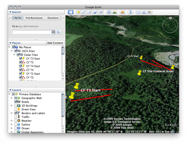
All eight 1KCS sites have been identified and recorded in Google Earth-compatible KML file. Each site has a placemark for the general site area, placemarks for the transect start points (if specified in the research documentation) and paths representing the approximate direction and length of each transect.
Viewing the sites in Google Earth is easy:
- If you don't already have it, you'll need Google Earth (free: http://earth.google.com).
- Download and unzip the KML file: 1KCS Sites.kml.
- Start Google Earth, goto File > Open, and choose the 1KCS Sites.kml file you just downloaded.
- There is now a "1KCS Sites" folder in "Places" on the left side of the screen.
- There are folders for each of the sites. To "Fly To" a site, double click on its folder, or open the folder and double click on the "General Area" placemark.
| Attachment | Size |
|---|---|
| 1KCS Sites.kml.zip | 6.71 KB |
| 1KCS Sites (GPS).kml.zip | 9.51 KB |