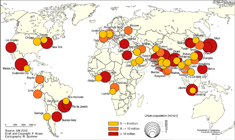
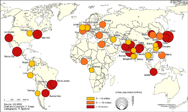
Megacities 2000 & 2015
Megacities: World's Largest Cities, usually >10 million People
Political Economy and Social Change: From Colonization to Globalization
Maps
Washington Maps
Seattle Census 2000 Demographics Maps
General Map Sites
Library of Congress Map Collection: 1500-2004
Perry-Castañeda Library Map Collection
TerraServer (Satellite Photos and Aerial Photography)
Earthshots: Satellite Images of Environmental Change
Washington State Environmental Learning Centers
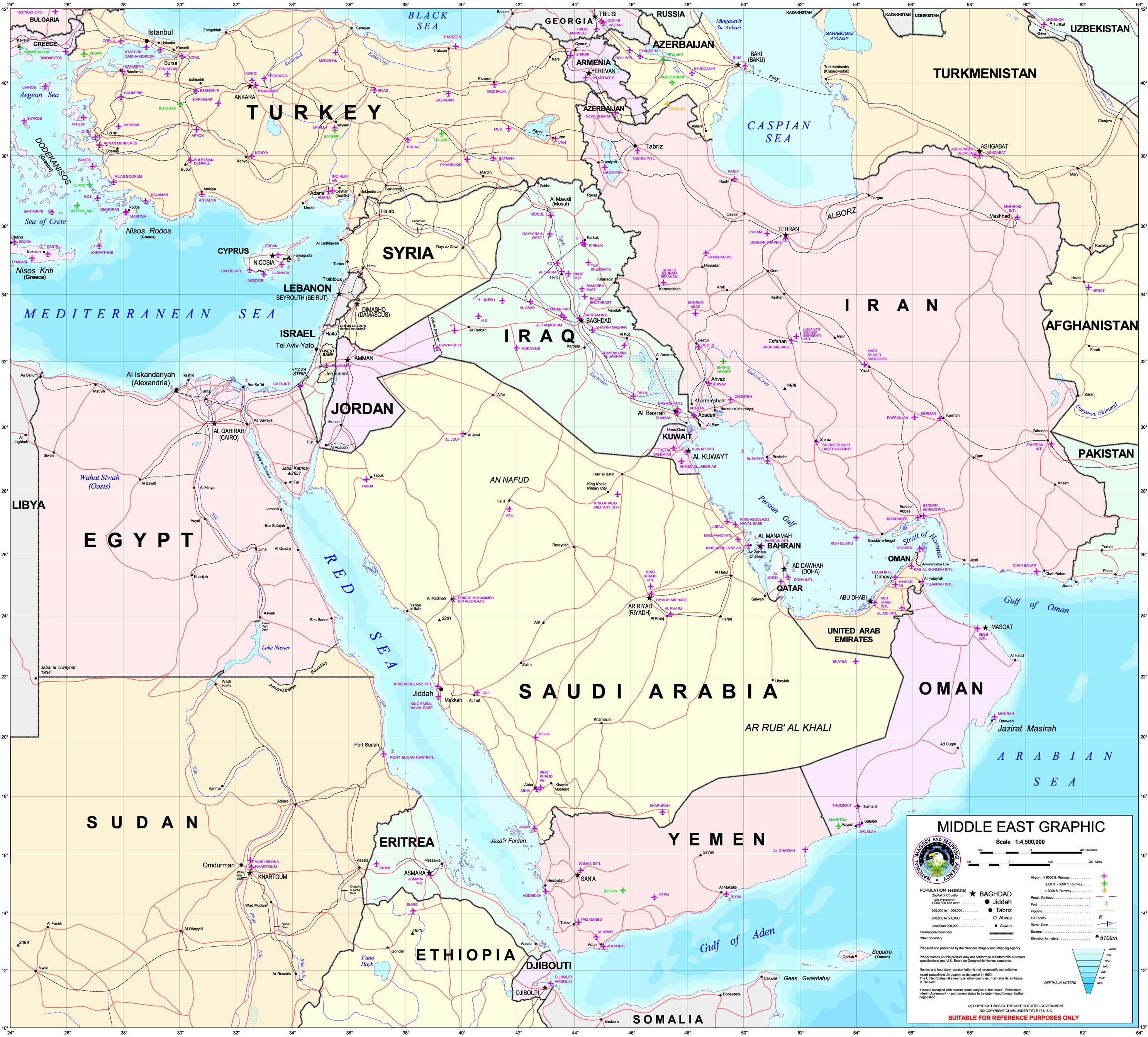
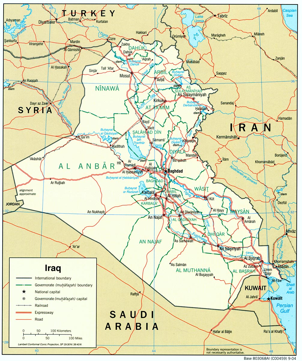
Specific Regions
Afghanistan 2003
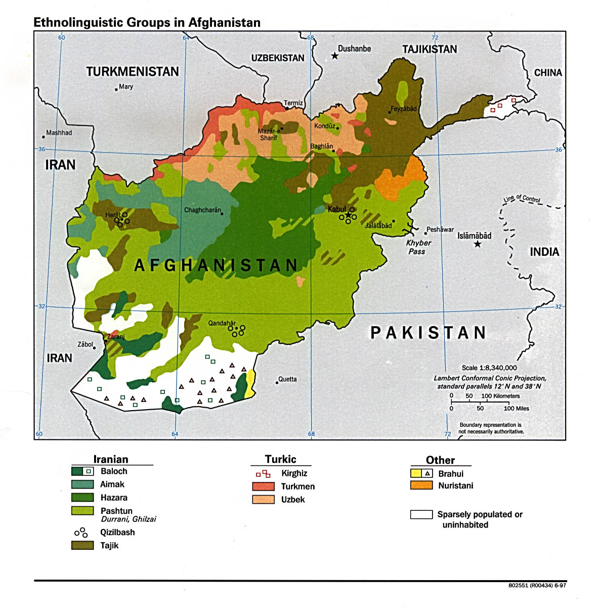
Afghanistan Ethnolinguistic Groups
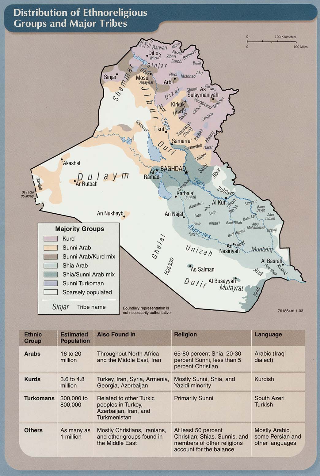
Distribution of Ethnoreligious Groups and Major Tribes
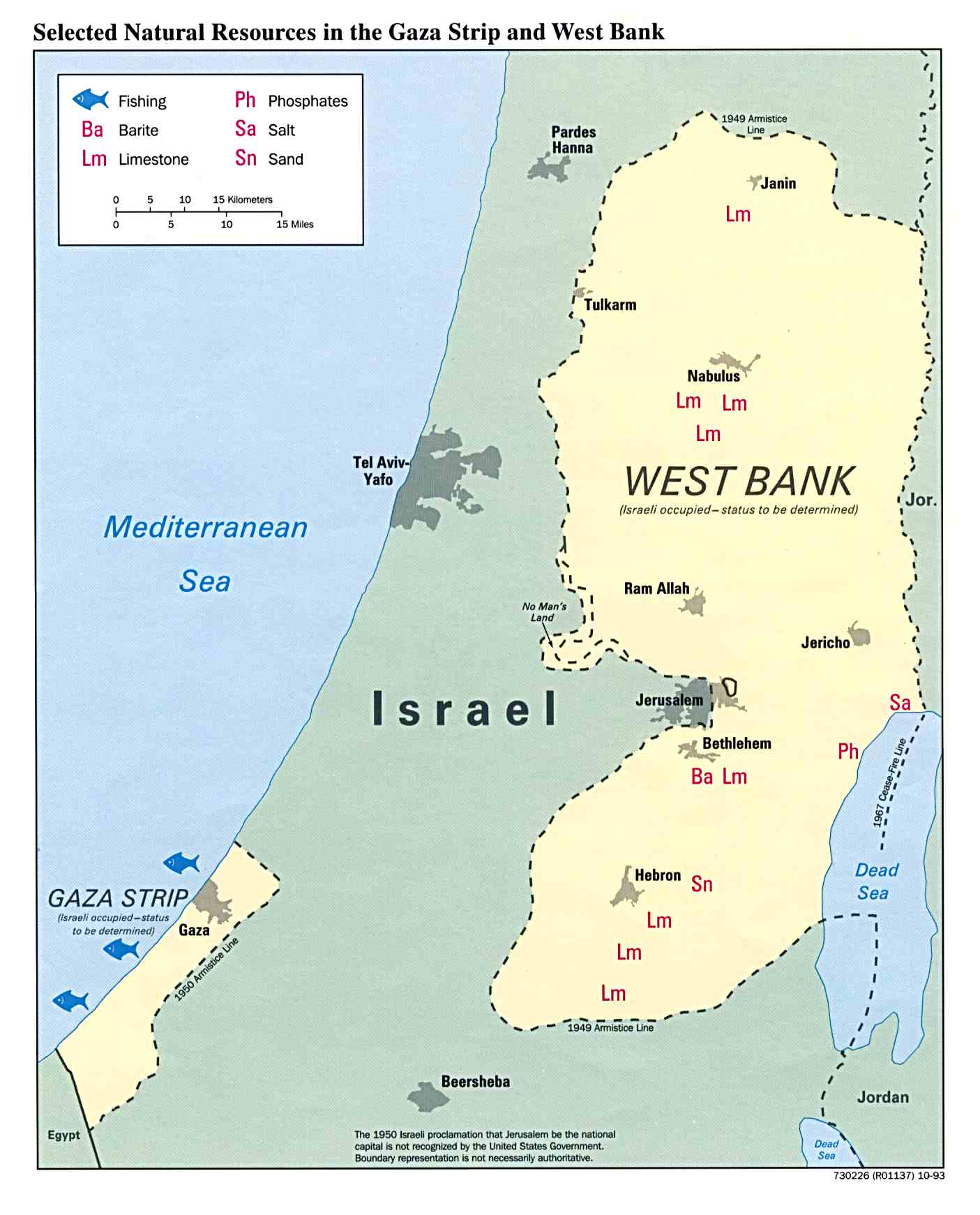
Palestinian Territories (occupied by Israel)
West Bank (large map)
West Bank Checkpoints
Gaza Checkpoints
Checkpoints North of Jerusalem
Population Trend and Rate of Urbanization
Mega Cities from ChannelOne.com includes interactive map and photos
US Military Bases Continental US (pdf)
US Military Deployment 1969-2004
US Military Bases around the world (pdf)
US Military Bases around the world II
Some Existing or Proposed Threats to Native Lands in Western North America