File:Harbor seal range.jpg
From marinelife1011

No higher resolution available.
Harbor_seal_range.jpg (529 × 454 pixels, file size: 35 KB, MIME type: image/jpeg)
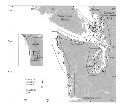
Map of harbor seal haulout sites and survey regions for Washington. The inland stock includes the Strait of Juan de Fuca (3), San Juan Islands (4), Eastern Bays (5), Puget Sound (6), and Hood Canal (7).
Map used with permission by Steve Jeffries (Washington Department of Fish & Wildlife.)
File history
Click on a date/time to view the file as it appeared at that time.
(Latest | Earliest) View (newer 100) (older 100) (20 | 50 | 100 | 250 | 500)| Date/Time | Thumbnail | Dimensions | User | Comment | |
|---|---|---|---|---|---|
| current | 13:04, 28 January 2011 |  | 529×454 (35 KB) | ABDLIS01 (Talk | contribs) | (Map of harbor seal haulout sites and survey regions for Washington. The inland stock includes the Strait of Juan de Fuca (3), San Juan Islands (4), Eastern Bays (5), Puget Sound (6), and Hood Canal (7). Credits to Steve Jeffries, 2003.) |
- Edit this file using an external application (See the setup instructions for more information)
File links
The following 3 pages link to this file:
