Houston Creek/B-Lot Piezometers
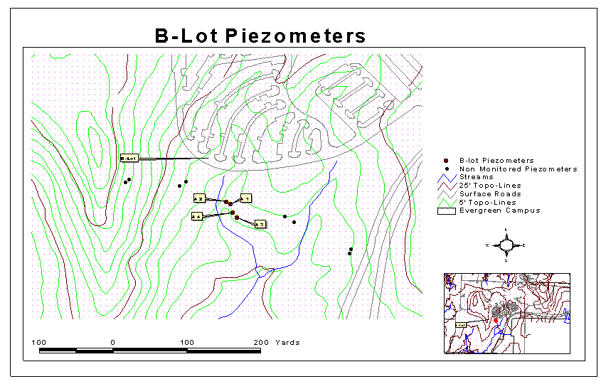
This area is located between the B and C parking lot and the Evergreen Parkway. The first four piezometers are located along Houston Creek. Houston Creek is the destination of most of the runoff water from B and C lots. Eight additional piezometers were installed in the fall of 2000. The forest types in this area are Douglas Fir/Western Hemlock, Alder and Big Leaf Maple. The wells are screened at different depths, so it is possible that they were used to study different aquifers.
In the spring of 2000, four piezometers were installed near Houston Creek, under an alder forest adjacent to parking lot B. The focus of this project by Spike Minczenski was to measure the hydrology of the water table fro the aquifer and Houston Creek. Water elevation data for the four piezometers is available from Febuary to May 2000. Other pertinent data are the soil logs compiled during the piezometer excavation. In the fall of 2000, environmental analysis students took the GPS points of the exixsting piezometers and dug eight new piezometers perpendicular to Houston Creek.
Photos of Aspen and
David sampling along Houston Creek
Back to Piezometers Homepage