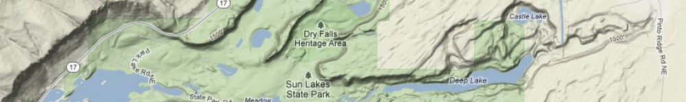
Basin Map
Reply
Legend: Pushpin=sigificant place Line=approximate route travelled
Legend: Pushpin=sigificant place Line=approximate route travelled
giant’sfootprint
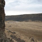
Dry Gully
Hanging Canyon
Legend: Pushpin=sigificant place Line=approximate route travelled Warning sign=warning
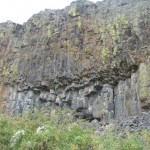
We ventured towards Deep Lake and found a cave that opened into a pothole. Climbing inside, we found that the pothole was inhabited by a few trees and shrubs, along with wheat and cheat grasses. The walls were about 20 … Continue reading
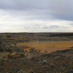
A theme at Dry Falls Lake was the sinificant amount of activity. There were repetitive clusters and clumps like the rocks, feces, bones and concentration of people. Red pin indicates our locaion, Dry Falls Lake Yellow pins indicate observations of interest
At Red Alkali Lake we defied Peters wise words, and climbed the loose basalt up to a cave. From there we watched, like hawks circling the sky, looking out at the dry valley. We watched Jayden almost get sucked into … Continue reading
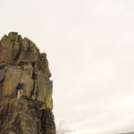
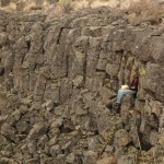
Umatilla Rock was much less of an adventure than any of the other sites, and the rocks were not at all safe to climb. However it was fun to image all the water flowing above and around the rock, and … Continue reading
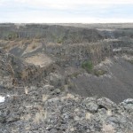
As we climbed to the top of the plateau, not knowing what was in store for us, our neurons fired with excitement. We were met with satisfaction when we reached the top. Our minds blown from the actual scale; the … Continue reading
On day two, the Carrot Spoons made the journey to La Mesa. On the way back, we explored a huge channel, which turned out not to be a shortcut. It was great anyway! Their track is meandering, and appears to … Continue reading
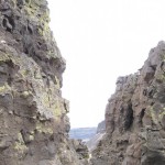
The Longitudinal groove we arrived at (with some difficulty) had little meaning for the non-specialist yet provoked a sense of being that made it memorable as a ‘place to be’. Red pin indicates our location, the longitunal groove Yellow pins indicate … Continue reading
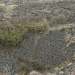
The pothole we visited was like a cavity of color and life within the open desert. The area is somewhat chaotic. The broken up rock strewn across the immediate surroundings signified action within the greater stillness of the landscape. Red pin indicates … Continue reading
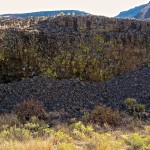
Potluck This is the pothole that our group went to on the first full day of being at Dry Falls. We stumbled upon it after climbing a treacherous and rocky path up to the plateau.
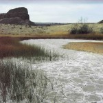
At Red Alkali Lake, there was evidence of the drought. Arid ground cracked beneath our feet and a hawk circled above, looking for any prey we might stir up. We sat on a boulder and watched the day go by, … Continue reading
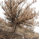
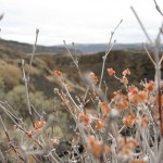
The southern escarpment is an area located just south of camp. Here, there was a small rock outcropping that we found shelter underneath when a few drops began to fall. Thick, golden grasses tickled our ankles and played with the … Continue reading
Legend: Pushpin= sigificant place Male/Female sign= starting point Arrow pointing to star= spider Line= approximate route travelled